En
Log in
All resources
Create a design
Tools
27,797 Free Images of British Library
maps from the earth and its inhabitants, vol. iv
the comprehensive history of england (1876)
english-language maps showing history
1870s maps showing history
a class-book of modern geography (1898)
maps from the earth and its inhabitants, vol. xiii
maps from the earth and its inhabitants, vol. xvi
the pied piper of hamelin illustrated by kate greenaway
kate greenaway
maps from the earth and its inhabitants, vol. xviii
maps from the earth and its inhabitants, vol. xiv
1870s maps of new zealand
the comprehensive history of england (1876)
english-language maps showing history
the comprehensive history of england (1876)
english-language maps showing history
maps from the earth and its inhabitants, vol. vii
floods in china
maps from the earth and its inhabitants, vol. vi
alay district
maps from the earth and its inhabitants, vol. xvii
anton francesco lucini
the comprehensive history of england (1876)
english-language maps showing history
maps from the earth and its inhabitants, vol. iv
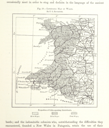
linguistic maps of wales
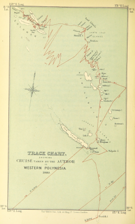
wanderings, south and east (1882)
old maps of polynesia
maps of the battle of the nile
battle of alexandria
a class-book of modern geography (1898)
1890s maps of montreal
reconstruction of ruysch's africa map by stanley
dans les ténèbres de l'afrique (1890)
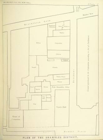
kingston upon hull (uncategorised)
thomas tindall wildridge
a class-book of modern geography (1898)
1890s maps of australia
from edinburgh to the antarctic. an artist's notes and sketches during the dundee antarctic expedition of 1892-93
william callow, r. w. s., f. r. g. s. (1908)
town hall of mechelen
a class-book of modern geography (1898)
1890s maps of colorado
den danske hærs historie til nutiden og den norske hærs historie indtil 1814
old maps of rügen
the pied piper of hamelin illustrated by kate greenaway
kate greenaway
a class-book of modern geography (1898)
1890s maps of central america
the comprehensive history of england (1876)
a class-book of modern geography (1898)
1890s maps of sweden
historical images of einsiedeln
engravings by edward whymper
den danske hærs historie til nutiden og den norske hærs historie indtil 1814
old maps of helsingborg
cornell's primary geography (1860)
old maps of lake geneva
a class-book of modern geography (1898)
1890s maps of hawaii
the pied piper of hamelin illustrated by kate greenaway
kate greenaway
palenque - temples of the cross
romanticism
ghosts & ghoulish scenes
den danske hærs historie til nutiden og den norske hærs historie indtil 1814
1870s maps of denmark
palenque - temple of the jaguar
romanticism
the pied piper of hamelin illustrated by kate greenaway
kate greenaway
the pied piper of hamelin illustrated by kate greenaway
kate greenaway
plants
botany
das königreich hannover und das herzogthum braunschweig dargestellt in malerischen original-ansichten ihrer interessantesten gegenden
the comprehensive history of england (1876)
english-language maps showing history
the comprehensive history of england (1876)
english-language maps showing history
the comprehensive history of england (1876)
english-language maps showing history
the comprehensive history of england (1876)
english-language maps showing history
maps from the earth and its inhabitants, vol. v
maps of sea ice
maps from the earth and its inhabitants, vol. vii
treaty ports
maps from the earth and its inhabitants, vol. xii
1710s maps of africa
ismailïa. a narrative of the expedition to central africa for the suppression of the slave trade (1874)
1874 maps of africa
the comprehensive history of england (1876)
danube in 1704
maps from the earth and its inhabitants, vol. iv
topographic maps of ireland
fauna bl - serpentes
gustav mützel
17th-century oil equestrian portraits of men
joseph parrocel
le désert et le monde sauvage
fauna bl - mammalia
maps from the earth and its inhabitants, vol. v
denmark in the 19th century
maps from the earth and its inhabitants, vol. xiii
maps of journeys
old maps of saint-louis (senegal)
orientalist painting
maps from the earth and its inhabitants, vol. xv
temperature maps of north america
maps from the earth and its inhabitants, vol. xii
19th-century maps of the azores
maps from the earth and its inhabitants, vol. xiv
old maps of sydney
maps from the earth and its inhabitants, vol. xviii
1870s maps of peru
maps from the earth and its inhabitants, vol. iv
19th-century maps of cornwall
le désert et le monde sauvage
folivora illustrations
maps of crossings of the atlantic ocean
1890s maps of the atlantic ocean
maps from the earth and its inhabitants, vol. xvi
1870s maps of mexico
maps from the earth and its inhabitants, vol. iv
1870s maps of london
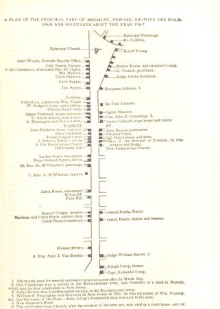
historical collections of the state of new jersey (1852)
maps of newark, new jersey
maps from the earth and its inhabitants, vol. vi
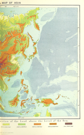
topographic maps of asia
dr. wilh. junker's reisen in afrika 1875-1886
friedrich rheinfelder
maps from the earth and its inhabitants, vol. xiii
maps indicating exploration
illiteracy in france
education in france
maps from the earth and its inhabitants, vol. xviii
old maps of valparaíso
maps from the earth and its inhabitants, vol. viii
maps of the mekong
maps from the earth and its inhabitants, vol. iv
cirencester
maps from the earth and its inhabitants, vol. xiii
19th-century maps of madagascar
maps from the earth and its inhabitants, vol. iv
old maps of windsor
the lands of scripture (1879)
architecture bl
maps from the earth and its inhabitants, vol. iv
19th-century double hemisphere world maps
19th-century maps of namibia
maps of walvis bay
maps from the earth and its inhabitants, vol. iv
maps of the humber estuary
maps from the earth and its inhabitants, vol. iv
maps of rochester, kent
maps from the earth and its inhabitants, vol. xvi
old maps of central america
maps from the earth and its inhabitants, vol. xv
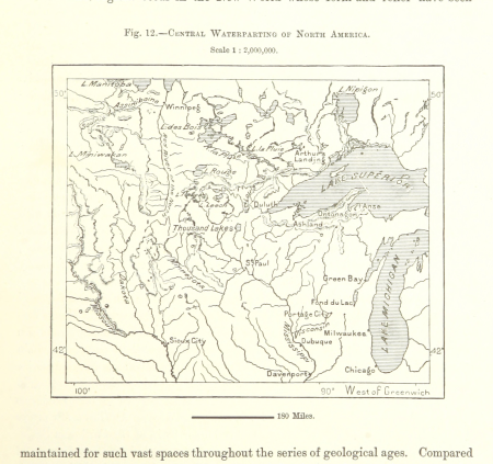
hydrological maps of the united states
maps from the earth and its inhabitants, vol. xvi
19th-century maps of mexico city
maps from the earth and its inhabitants, vol. xvi
19th-century maps of jamaica
maps from the earth and its inhabitants, vol. ii
st malo
maps from the earth and its inhabitants, vol. iv
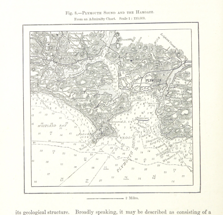
charts of plymouth sound
maps from the earth and its inhabitants, vol. xvii
linguistic maps of north america
maps from the earth and its inhabitants, vol. v
1870s maps of finland
maps from the earth and its inhabitants, vol. xviii
maps of indigenous territories of colombia
maps of the districts of the canton of bern
biel/bienne (administrative district)
hamburg: historisch-topographische und baugeschichtliche mittheilungen
marmorkapelle (schröderstift)
maps from the earth and its inhabitants, vol. xi
oases of libya
maps from the earth and its inhabitants, vol. x
19th-century maps of the nile delta
maps from the earth and its inhabitants, vol. x
maps of lake victoria
maps from the earth and its inhabitants, vol. x
canals in egypt
maps from the earth and its inhabitants, vol. xi
roads in tunisia
maps from the earth and its inhabitants, vol. xii
maps of ocean currents
maps from the earth and its inhabitants, vol. xvi
maps of the mexican war of independence
maps from the earth and its inhabitants, vol. iv
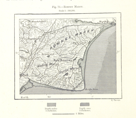
romney marsh
maps from the earth and its inhabitants, vol. iv
1870s maps of scotland
maps from the earth and its inhabitants, vol. xviii
old maps of valparaíso
historical collections of the state of new jersey (1852)
prisons in new jersey
historical collections of the state of new jersey (1852)
stony brook, new jersey
orientalist painting
old maps of dakar
maps from the earth and its inhabitants, vol. xiii
old maps of luanda
25001 - 25100 of 27,797
Next page
/ 278